In view of the impending legal obligation to make development plans INSPIRE-compliant (Infrastructure for Spatial Information according to the EU regulation) by October 2020, the Ludwigsburg District Office concluded agreements with 31 municipalities at an early stage to digitize the development plans. Thanks to this forward-looking approach and the active support of the municipalities, it has been possible to digitize all development plans.
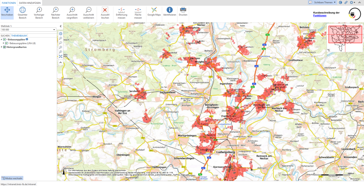
Currently, 18 municipalities have made their development plans available for presentation on the district's viewer. All citizens now have the opportunity to view the georeferenced development plans and the associated information on the district's homepage.
With this viewer, all users can navigate digitally through the district, search for locations and development plans and display the development plans in the correct position on the map. District Administrator Dietmar Allgaier is proud of the new online presentation of the development plans in the district: "More new and current topics will follow."
The viewer can be accessed via the link https://karo.landkreis-ludwigsburg.de/weboffice_buerger/synserver?client=core&project=LRALB_BPL